 English











Ilustratīvs attēls
At the end of May, the software development phase of the large-scale Latvian port cooperation project “Digital Transformation of Port Management” was completed. As a result of the project, for the first time in Latvia a unified digital platform has been created, integrating the core operational processes, geospatial data, and digital services of the ports of Riga, Ventspils, and Liepāja. The final implementation phase of the digital transformation project for Latvia’s ports and logistics corridors is currently underway.
The “Digital Transformation of Port Management” project is being implemented with support from the European Union’s Recovery and resilience Facility, it is the first large-scale collaboration project among Latvia’s major ports, creating a unified digital basis for port development and closer cooperation in the future.
By integrating Latvia’s three largest ports into a single digital ecosystem, more efficient data exchange, service delivery, and cooperation among ports, government agencies, and companies in the logistics sector is being promoted. At the same time, the competitiveness of Latvia’s ports within international transport corridors are boosted, providing conditions for the development of new multimodal services and modern, data-driven port management.
“This is a historic cooperation project for Latvia’s port sector. During its implementation, we have demonstrated that by combining knowledge, experience, and resources, it is possible to create solutions that simultaneously serve the interests of all ports and the entire sector. This experience of collaboration is one of the project’s most significant benefits and a solid foundation for future joint development projects,” said Ansis Zeltiņš, the Freeport of Riga CEO.
Four mutually integrated digital solutions have been developed as part of the project: the Port Information System, which manages core port operations, the Port Community System, which provides port customers with unified access to all port digital services, a Pass and Survey Solution, and a Geospatial Information Solution - and their implementation is currently underway.
The project’s geospatial information solution involves the development and implementation of three components to meet the needs of all three ports. The Port Geographic Information System (GIS) ensures the unified collection, storage, visualization, and analysis of geospatial data related to port territories, infrastructure, and facilities. The Automatic Identification System (AIS) is a real-time vessel tracking and traffic monitoring tool for identifying vessels, tracking them in real time, and monitoring vessel traffic in Latvian territorial waters. The integration component ensures the exchange of geospatial data with other information systems developed within the framework of the project.
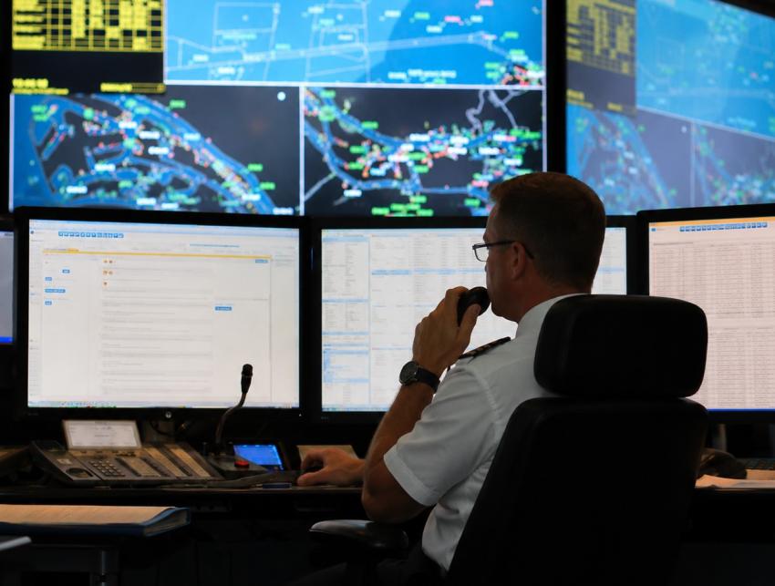
The real-time vessel tracking and traffic monitoring tool for the Automatic Identification System (AIS), developed as part of the “Digital Transformation of Port Management” project, is the first of the project’s solutions already being used by the ports of Riga, Ventspils, and Liepāja in their daily operations.
This solution allows port authorities to view any vessel in Latvian territorial waters in real time, track its route, and predict its estimated time of arrival at the port.
“We began using the new AIS system in test mode back in March. Since then, the solution has been continuously improved, and its development is still ongoing. We can see that the system provides significant benefits in our daily work. It has been tailored specifically to the needs of the Port of Ventspils, as well as to modern technological requirements. We can precisely track vessel movements, predict their arrival times, and plan the Harbour Master’s Office’s work more effectively,” emphasized Ainārs Austrums, Harbour Master of the Port of Ventspils.
Gints Ažēns, Harbor Master of the Port of Liepāja, also rates the new system positively: “The AIS solution is a significant asset to the Port of Liepāja’s day-to-day operations. The system was developed specifically for the needs of ports - it is easy to use; it provides accurate real-time information on vessel movements and significantly improves work planning capabilities. It is a modern tool designed for practical use.”
Currently, the AIS solution is in use at the ports of Riga, Ventspils, and Liepāja, but in the future, the user base may be enlarged to include other Latvian ports. Options are also being considered to expand the system’s geographic coverage so that ports can receive data not only from vessels in Latvian territorial waters but from all vessels sailing in the Baltic Sea.

Information for media

- [email protected], +371 670 308 53
- Freeport of Riga Authority
- 12 Kalpaka blvd, Riga, Latvia, LV-1010